Explore the best places
Beach in Portugal
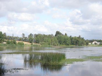
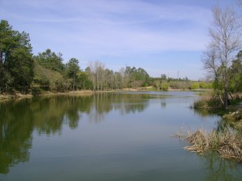
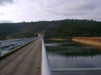
Barragem do Paúl de Magos
- beach
- country
Barragem do Paúl de Magos
2120, Vale do Zebro
A dam with tree-lined banks located on the left bank of the Tietê River (Ribeira de Magos). It has a pier, access ramps, and a river beach (Paul de Magos).
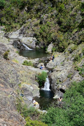
Ribeira de Quelhas
- beach
- country
Coentral
3280, Coentral
Explore the Ribeira de Quelhas on foot, as it's not accessible by car. And thankfully, it's a true feast of nature, encompassing shale ravines of unique beauty. The variety of trees is extensive: Portuguese oaks, holly, strawberry trees, and chestnut trees. Enjoy the song of the jays.
Foz do Rio Paiva
- beach
- country
Rio Paiva
4550, Castelo
The Paiva River rises in the Serra da Nave, in Moimenta da Beira, and flows into the Douro, in Castelo de Paiva. It was once considered the least polluted river in Europe and remains a spawning ground for trout. It offers opportunities for hydrospeed and other water sports.
Albufeira do Bonito
- beach
- country
Casal do Grilo
2330, Entroncamento
This artificial reservoir offers sport fishing and canoeing. There's a picnic area, a scouting park, an archery and crossbowman's park, and a forested area. Restrooms and changing rooms are also available as support facilities.
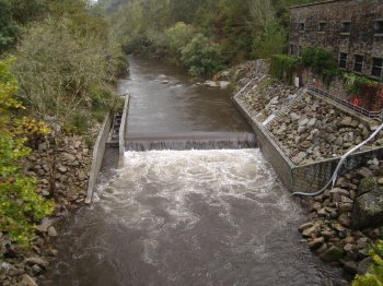
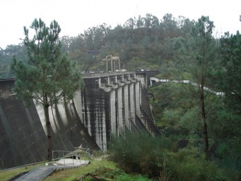
Barragem do Torrão
- beach
- country
EN312
4575, Torrão
Gravity dam located on the Tâmega River, 3.5 km from the confluence of the Tâmega with the Douro.
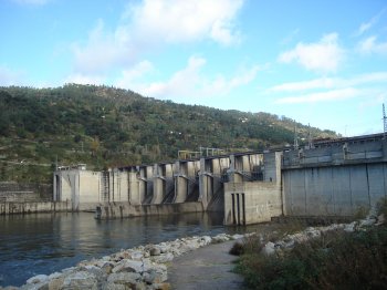
Barragem do Carrapatelo
- beach
- country
Barragem do Carrapatelo
4625, Mourilho
Gravity dam on the Douro River, surrounded by forested slopes and large boulders. Fishing and surfing are permitted, with restrictions. Boat use is permitted.
Rio Mondego
- beach
- country
Quinta das Cortinhas
6370, Fornos de Algodres
The Mondego River is the largest Portuguese river, rising in the Serra da Estrela, at a place called Mondeguinho, at an altitude of approximately 1,425 meters, and flowing 258 kilometers into the Atlantic Ocean near Figueira da Foz. Its tributaries are the Dão River on the right bank, and the Alva, Ceira, and Arunca Rivers on the left.
Barragem da Apartadura
- beach
- country
Rasa
7330, São Salvador da Aramenha
Dam located on the Ribeira de Reveladas (Tejo River Basin). It is used for irrigation and water supply. The Apartadura reservoir area is located within the Serra de São Mamede Natural Park. It allows for the practice of motorless water sports.
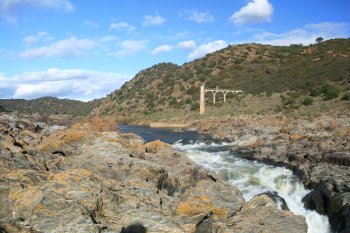
Pulo do Lobo
- beach
- country
Pulo do Lobo
7750, Mértola
Straddling the municipalities of Mértola and Serpa, this waterfall is of rare beauty. It's approximately 14 meters high, in a place of rich geological heritage, where the river flows with a tremendous roar between two cliffs. A narrow rocky strait strangles the river so much that it overflows, forming a waterfall. The imposing landscape lends a unique beauty to this place, steeped in legend and history. During floods, the drop in water level is reduced, allowing several species to travel upstream to spawn.
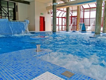
Termas de Monção - Centro Tesal
- beach
- leisure
Avenida das Caldas
4950-442, Monção
Located on the banks of the Minho River, with Salvaterra (across the river) as a backdrop, the Termas de Monção hot springs are surrounded by greenery. The large trees, dirt paths, and water fountains invite you to take invigorating walks throughout the park. The medicinal waters treat respiratory conditions, rheumatic and musculoskeletal diseases, and skin conditions.