Explore the best places
Natural Resources in Montalegre
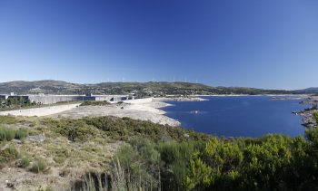
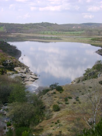
Albufeira do Alto Rabagão
- beach
- country
Albufeira do Alto Rabagão
5470, Montalegre
A mixed dam, part gravity and part arch, fed by the Rabagão River, belonging to the Cávado River Basin. Completed in 1964, it stands 94 meters high and 1,897 meters long at the crest, with a maximum discharge capacity of 500 m3/s. It is the second-largest dam in Portugal, after the Alqueva Dam, and is highly sought after by fishermen. Other sports and leisure activities, such as surfing and motorboating, are also permitted.
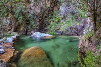
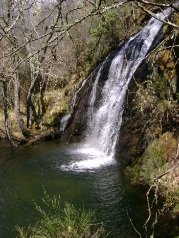
Cascata de Pitões das Júnias
- beach
- country
Pitões das Júnias
5470, Pitões das Júnias
The Pitões das Júnias waterfall, located in the heart of Peneda-Gêres National Park, is fed by the crystal-clear waters that flow past the Santa Maria das Júnias Monastery. It has a first drop of about 30 meters, followed by several more. This entire landscape is surrounded by a beautiful, centuries-old oak forest.
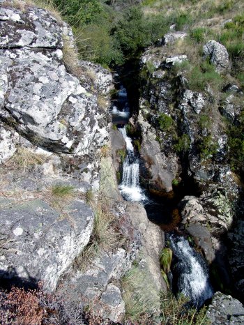
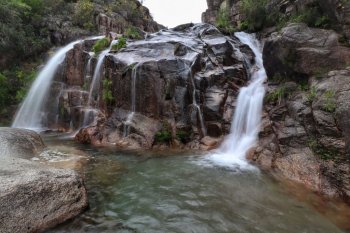
Cascata de Pincães
- beach
- country
Cabril
5470-011, Cabril
Esta é uma das cascatas mais bonitas do Parque Nacional da Peneda-Gerês. Para lá chegar, deve seguir o caminho que vem da aldeia por um trilho com cerca de dois quilómetros.
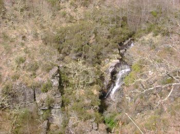
Cascatas de Firvidas
- beach
- country
Cascatas de Firvidas
5470, Montalegre
Waterfalls accessible only on foot, with restricted access through a path on the ground often flooded. Place of great natural beauty, surrounded by vegetation and rocky cliffs.
Cascata Cela Cavalos
- beach
- country
Outeiro
5470, Outeiro
Waterfalls in the Peneda-Gerês National Park. The access is difficult.
Cascata Barrondas
- beach
- country
Travassos
5470, Montalegre
Waterfall in the National Park of Peneda-Gerês, more precisely at Travassos, accessing-posing as a footpath of about 2 kilometres. It is a medium-sized waterfall surrounded by tall green hills, creating a breathtaking scenario.
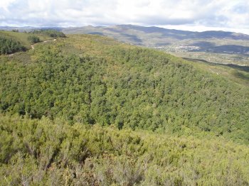
Carvalhal do Avelar
- country
Montalegre
5470, Montalegre
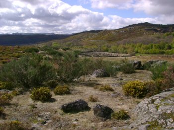
It is a large Virgin green area and great natural beauty. It is here the Fojo do Lobo of Avelar and the Miradouro da Senhora Das Treburas, offering magnificent panoramic views. The level of grass are the Pyrenean Oaks and Oak, the Phoenicean Juniper or Pine, Holly, Genista, Heather and Gorse. The Pyrenean Oak is the dominant species, since it adapts easily to mountain slopes, enduring the cold and the snow so characteristic of winters Barrosões.
Serra do Larouco
- country
Serra do Larouco
5470, Montalegre
Located to the northeast of Montalegre, it belongs to the Old Massif. It measures 10 km and it is the second highest mountain in Portugal, with its peak at an altitude of 1527 metres, at the Fonte da Pipa (Barrel Fountain). From the top, one views the Lima, Tâmega, Cávado and Rabagão valleys, as well as several villages and the small town of Montalegre. Besides the landscapes, there are also horses and one can do mountain sports, such as hang gliding, paragliding, climbing and walks.
Rio do Alto Rabagão
- beach
- country
Rio do Alto Rabagão
5470, São Vicente da Chã
A river that is tributary of the Cávado river's left bank, born between the Barroso and the Larouco hills. It is 37 km long and it is used for producing electricity at the Alto Rabagão and Venda Nova dams. The access to the sping is by foot, after Codeçoso.
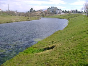
Rio Cávado
- beach
- country
Montalegre
5470, Montalegre
A river that has its spring on the Larouco hill, at an altirude of about 1520 metres. The river crosses Braga, Barcelos and has its mouth by Esposende. It is 135 kilometres long.